2020 Hurricane Season

Lots of things started beeping loudly around 4:30 this morning. We are one county inland from the coast but included in the hurricane warning now.

Latest model runs do not look good.
Hopefully, she stays catty-wampus and doesn’t strengthen too much.
 
The one NHC operational model that has been bullish on intensity this season had a 125-mph storm in its prior run. In the latest run 6 hrs later, it barely gets it to hurricane status.

That is a head-scratcher.
 
I’m always hoping for no hurricanes for obvious reasons. When they hit the Naples area my wife’s mom shows up are home in MN for a week or two and with me not working that can sometimes be not the ideal situation, lol.
 
Hopefully, she stays catty-wampus and doesn’t strengthen too much.

I learned a new word! I will have to work that into a report at work this week.
 
Supposed to be a cat 1 when it lands? This season is truly crazy... feel bad for everyone in Nola, souther miss right now...
 
You can drive yourself crazy watching all the obs and model data come in throughout the day.
 
Welcome to the party, Alabama.
CHANGES WITH THIS ADVISORY:

The Hurricane Warning has been extended eastward from Ocean Springs
Mississippi to the Mississippi/Alabama Border.

A Storm Surge Warning has been extended eastward from the
Mississippi/Alabama border to the Alabama/Florida Border, including
Mobile Bay.
 
Uh, ok.

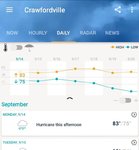
Screenshot_20200914-075314_AccuWeather.jpg
 
SUMMARY OF 1000 AM CDT...1500 UTC...INFORMATION
-----------------------------------------------
LOCATION...28.4N 86.9W
ABOUT 140 MI...230 KM ESE OF THE MOUTH OF THE MISSISSIPPI RIVER
ABOUT 185 MI...295 KM SE OF BILOXI MISSISSIPPI
MAXIMUM SUSTAINED WINDS...65 MPH...100 KM/H
PRESENT MOVEMENT...WNW OR 285 DEGREES AT 6 MPH...9 KM/H
MINIMUM CENTRAL PRESSURE...991 MB...29.27 INCHES

SUMMARY OF 1100 AM CDT...1600 UTC...INFORMATION
-----------------------------------------------
LOCATION...28.6N 86.9W
ABOUT 135 MI...220 KM ESE OF THE MOUTH OF THE MISSISSIPPI RIVER
ABOUT 175 MI...280 KM SE OF BILOXI MISSISSIPPI
MAXIMUM SUSTAINED WINDS...85 MPH...140 KM/H
PRESENT MOVEMENT...WNW OR 285 DEGREES AT 6 MPH...9 KM/H
MINIMUM CENTRAL PRESSURE...985 MB...29.09 INCHES

SUMMARY OF 1130 AM CDT...1630 UTC...INFORMATION
-----------------------------------------------
LOCATION...28.7N 87.0W
ABOUT 130 MI...210 KM ESE OF THE MOUTH OF THE MISSISSIPPI RIVER
ABOUT 165 MI...265 KM SE OF BILOXI MISSISSIPPI
MAXIMUM SUSTAINED WINDS...90 MPH...150 KM/H
PRESENT MOVEMENT...WNW OR 285 DEGREES AT 7 MPH...11 KM/H
MINIMUM CENTRAL PRESSURE...986 MB...29.12 INCHES

 
I saw on Mike's Weather Page FB account that Sally could hit 105 at landfall. Good thing is the tracks are sliding east so that gets the worst stuff away from you.
 
 
The sun made its final appearance here for a few days (maybe?) about an hour ago, as the dense overcast arrived. We got a passing shower on the far western periphery of the storm shortly after.

The golf course is closing at 4 pm today and hopes to reopen on Wednesday.
 
Last edited:
just saw the first bit of rain at the house about 20 minutes ago.
 
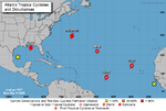
5 named storms in the Atlantic right now. There's only one name left on the 2020 list (Wilfred).

1600119681598.png
 
And, we're out of the 'cone' now with the 4 pm updates. The NHC's consensus model keeps trending eastward with time. Forget Louisiana, Sally may not even make it to Mississippi, at this point.
 
Some late strengthening, an eye is popping, and landfall may end up in FL.
 
o_O
...11 PM CDT POSITION UPDATE...
...SALLY STRENGTHENS WHILE MOVING SLOWLY NORTH-NORTHEASTWARD...

Data from An Air Force Reserve reconnaissance aircraft and
the Mobile Alabama Doppler weather radar indicate that Sally has
strengthened to 90 mph (150 km/h).
 
Power went out again a couple minutes ago. Just heard a transformer explode. Barely even raining right now.
 
We need to have another golf thing, its getting closer to cool wonderful weather. Can anyone say Kinderlou!!
 
Back
Top